
The summer may be drawing to a close, but there’s a still a few more weeks of mild weather left, and plenty of hikes that are still accessible near Vancouver this fall.
From easier strolls for those who aren’t ready to work up a sweat quite yet, to harder hikes for the tougher grizzlies among you, there’s something out there with your name on it.
Here’s a roundup of some of our favourite hikes in and around Vancouver for this fall. Make sure you read up on the dangers of hiking and what to pack before you head out, and have fun out there.
Easier
Thunderbird Ridge
What: A quick hike from the top of Grouse Mountain, only recommended until the end of September. On a clear day, you’ll be able to see scenic views of Crown Mountain, Kennedy Lake and Vancouver, as you wander along the alpine trail behind Grouse.
How long: 2.5 hours or 6 km
Where: Starts and ends at the top of Grouse Mountain – 6400 Nancy Greene Way, North Vancouver.
Get there: A 30-minute drive from downtown, or take the Seabus plus bus 236 to its final stop, Grouse Mountain – then take the Grouse Mountain Skyride gondola.
Quarry Rock

The view from Quarry Rock (Guilhem Vellut/Flickr)
What: A classic North Shore hike, up wooden stairs, over tree roots and small creeks, among Douglas Fir and Hemlock trees, to a rocky outcrop and beautiful views of Deep Cove. Recommended all year round.
How long: 1.5 hours or 3.8 km
Where: Starts and ends at the Baden Powell Trailhead – Panorama Drive, Deep Cove.
Get there: A 30-minute drive from downtown, or take the Seabus plus buses 239 then 212 instead.
Goldie Lake
What: This easy trail meanders through the forest on top of Mount Seymour before opening up to reveal a lovely lake and a great spot for lunch. Not recommended after October.
How long: 2 hours or 3 km
Where: Starts and ends at the parking area of Mount Seymour – 1700 Mount Seymour Road, North Vancouver.
Get there: A 50-minute drive from downtown Vancouver
Lighthouse Park

Image: Lighthouse Park / Shutterstock
What: Lots of short, easy trails offering breathtaking ocean views, huge, old-growth Western Red Cedars and the picturesque picnic spot of Starboat Cove. Recommended all year round.
How long: Up to 2 hours or 6 km
Where: Starts and ends at Lighthouse Park parking lot – Beacon Lane, West Vancouver.
Get there: A 40-minute drive from downtown, or take bus 250 all the way there instead.
Dam Mountain

The view from Dam Mountain (Ruth Hartnup/Flickr)
What: A short but steep hike into the backcountry behind Grouse Mountain, up to a rocky outcrop. You’ll get occasional glimpses of the Howe Sound and Cypress Mountain, as well as Burrard Inlet and Crown Mountain. Not recommended after September.
How long: 2 hours or 5 km
Where: Starts and ends at the top of Grouse Mountain – 6400 Nancy Greene Way, North Vancouver.
Get there: A 30-minute drive from downtown, or take the Seabus plus bus 236 to its final stop, Grouse Mountain – then take the Grouse Mountain Skyride gondola.
Capilano Pacific Park

See the Cleveland Dam in action at the end of this hike (Kyle Pearce/Flickr)
What: This trail follows the Capilano River, taking you from pavement, rocky shores and beaches past steep cliffs and through thick rainforest to the imposing Cleveland Dam. Recommended all year round.
How long: 2 hours or 7.5 km
Where: Starts at Ambleside Beach in West Vancouver, finishes at the Cleveland Dam in North Vancouver.
Get there: A 15-minute drive from downtown, or take bus 250 or 251 to a stop nearby instead.
Mystery Lake
What: A super easy hike, albeit over tree roots and loose rocks, to a great swimming spot in Mount Seymour National Park. Not recommended after October.
How long: 1.25 hours or 3 km
Where: Starts and ends at the parking area of Mount Seymour – 1700 Mount Seymour Road, North Vancouver
Get there: A 50-minute drive from downtown Vancouver.
Lynn Loop

Lynn Creek (Colin Knowles/Flickr)
What: Enjoy a forest hike among Cedar and Hemlock trees, with views of Vancouver Island and some of the Gulf Islands, then stroll back along the gushing waters of Lynn Creek. Recommended all year round.
How long: 1.5 hours or 5.1 km
Where: Starts and ends in Lynn Headwaters Regional Park – Lynn Valley Road, North Vancouver.
Get there: A 40-minute drive from downtown, or take the Seabus then 228 bus instead.
Little Goat Mountain
What: Another short, uphill hike in the backcountry behind Grouse Mountain, offering views of Crown Mountain and Goat Mountain. Not recommended after September.
How long: 2.5 hours or 5.5 km
Where: Starts and ends at the top of Grouse Mountain – 6400 Nancy Greene Way, North Vancouver.
Get there: A 30-minute drive from downtown, or take the Seabus plus bus 236 to its final stop, Grouse Mountain – then take the Grouse Mountain Skyride gondola.
Cypress Falls
What: This easy hike takes you along Cypress Creek, through forests of moss-covered, old-growth trees, past views of two gorgeous waterfalls as they pour into the canyon below. Recommended all year round.
How long: 1.5 hours or 3 km
Where: Trail starts and ends at Cypress Falls Park – Woodgreen Place, West Vancouver.
Get there: A 30-minute drive from downtown, or take bus 253 Caufield all the way there instead.
Dog Mountain

The view from Dog Mountain (Kyle Pearce/Flickr)
What: This may be a short hike, but it has a spectacular view of Vancouver on a clear day. Watch out for slippery tree roots, as you make your way past a lake, across streams and over wooden bridges, before reaching this rocky outcrop. Not recommended after October.
How long: 1.5 hours or 3 km
Where: Starts and ends at the parking area of Mount Seymour – 1700 Mount Seymour Road, North Vancouver.
Get there: A 50-minute drive from downtown Vancouver.
Harder
Eagle Bluffs

View from Eagle Bluffs (McKay Savage/Flickr)
What: This route from Cypress Mountain, past Cabin Lake and Black Mountain, is steep but rewarding, with spectacular views of the Lions and Brunswick Mountain, as well as Bowen Island and the Sunshine Coast. Not recommended after October.
How long: 4 hours or 8 km
Where: Starts and ends at the Cypress Mountain ski area parking lot – 6000 Cypress Bowl Rd, West Vancouver.
Get there: A 45-minute drive from downtown Vancouver.
Baden Powell Lynn Canyon To Grouse
What: This route hugs the North Shore’s steep mountain slopes, taking you through scenic forests and over several creeks – with quite a lot of stairs and uphill sections. Recommended all year round.
How long: 5 hours or 10 km
Where: Starts at a steep set of stairs between the main and overflow parking area in Lynn Headwaters Regional Park and ends at the base of Grouse Mountain.
Get there: A 40-minute drive from downtown to Lynn Headwaters Regional Park, or take the Seabus plus bus 228 instead. Get home from Grouse on bus 236 plus the Seabus.
Grouse Grind

Hikers doing the Grouse Grind on Vancouver’s North Shore (Grouse Grind/Facebook)
What: There’s no escape. If you haven’t already tackled Mother Nature’s stairmaster this summer, time is running out to get your new personal best. You know the score – a one-way climb of more than 850 m in under 3 km up the side of Grouse Mountain. Trail markers note your progress in elevation, not distance. Not recommended after September.
How long: Up to 2 hours or 2.9 km (or 853 m climb!)
Where: Starts at the parking lot at the base of Grouse Mountain, ends at the top.
Get there: A 30-minute drive from downtown Vancouver, or take the Seabus plus bus 236 to Grouse Mountain.
Big Cedar And Kennedy Falls Trail

Kennedy Falls in North Vancouver (Colin Knowles/Flickr)
What: A rugged hike into the backcountry, across roots, creeks and fallen trees, past an old-growth cedar, with several trees growing on it, and ending at a spectacular waterfall. Recommended all year round.
How long: 5 hours or 10 km
Where: Starts and ends at the top of Mountain Highway.
Get there: A 30-minute drive from downtown, or take bus 210 instead.
Mount Seymour

Crazy clouds from the top of Mount Seymour (Josh Stuart/Flickr)
What: A steep hike up one of the mountains you’ll likely come bombing down once the snow falls, a couple of months later. Full of wild foliage, wooden bridges and rocky hills, it’s worth the effort, for the incredible view of Vancouver at the top. Not recommended after October.
How long: 5 hours or 9 km
Where: Starts and ends at the parking area of Mount Seymour – 1700 Mount Seymour Road, North Vancouver.
Get there: A 50-minute drive from downtown Vancouver
Baden Powell Deep Cove To Lynn Canyon
What: This hike begins with a walk up to Quarry Rock, offering sweeping views of Deep Cove and Indian Arm, then continues onto lush forest, scenic canyons and waterfall views. Recommended all year round.
How long: 5 hours or 12 km
Where: Starts at the Baden Powell Trailhead on Panorama Drive in Deep Cove and ends at Lynn Canyon Suspension Bridge.
Get there: A 30-minute drive from downtown, or take the Seabus plus buses 229 then 212 instead. From Lynn Canyon, take bus 229 then the Seabus.
Mount Strachan
What: A challenging hike up one of the three mountains which form the Cypress Mountain ski resort, you’ll pass the historical debris of a crashed Royal Canadian plane on your way to views of the Howe Sound. Not recommended after October.
How long: 5.5 hours or 10.5 km
Where: Starts and ends at the Cypress Mountain ski area parking lot – 6000 Cypress Bowl Rd, West Vancouver.
Get there: A 45-minute drive from downtown Vancouver.
Norvan Falls
What: This hike will have you clambering over streams, tree roots and rubble as you make your way through groves of old-growth Cedar – but it’s all worth it when you get to the falls. Recommended all year round.
How long: 5 hours or 14 km
Where: Starts and ends at the parking lot of Lynn Headwaters Regional Park.
Get there: A 40-minute drive from downtown, or take the Seabus plus bus 228 instead.
St. Mark’s Summit
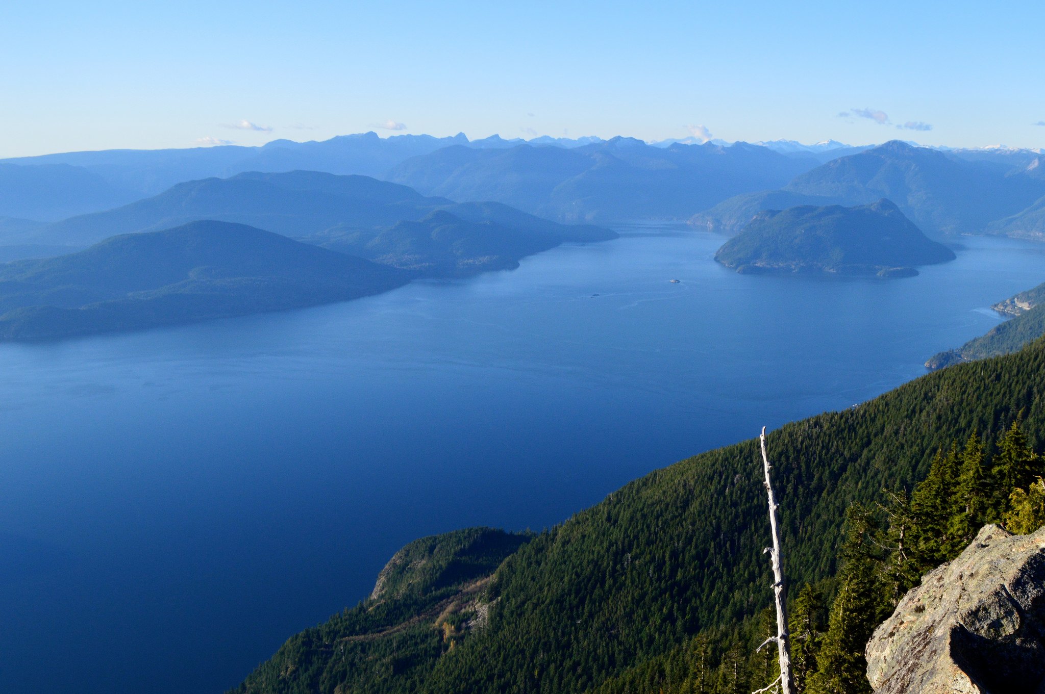
What: Part of the Howe Sound Crest Trail which winds alongside Cypress Mountain, this hike features a lot of steep switchbacks, so be prepared. At the top, it’s all worth it, for the amazing views of the Howe Sound, the Tantalus Range, the Gulf Islands and Vancouver Island on a clear day. Not recommended after October.
How long: 5 hours or 11 km
Where: Starts and ends at the Cypress Mountain ski area parking lot – 6000 Cypress Bowl Rd, West Vancouver.
Get there: A 45-minute drive from downtown Vancouver.
Brothers Creek Loop
What: This hike, open to the public but on private property, offers glimpses of waterfalls and takes you past the Candelabra Fir, a huge tree that towers over the surrounding forest. Not recommended after November.
How long: 4 hours or 7 km
Where: Starts and ends on Millstream Road near Henlow Road in the British Properties area.
Get there: A 30-minute drive from downtown, or take buses 250 then 254 instead.
Goat Mountain
What: This is a picturesque, if steep hike, featuring rocky slopes and switchbacks, ropes and chains, and a scramble to the top. But what a reward when you get there – views of Vancouver, Mount Baker, Vancouver Island, and Garibaldi Provincial Park mountains. Not recommended after October.
How long: 4 hours or 8 km
Where: Starts and ends at the top of Grouse Mountain – 6400 Nancy Greene Way, North Vancouver.
Get there: A 30-minute drive from downtown, or take the Seabus plus bus 236 to its final stop, Grouse Mountain – then take the Grouse Mountain Skyride gondola.
Hollyburn Mountain
What: This tough hike isn’t recommended after October, so get going. After ploughing uphill for 450 metres – including a very steep last section – you’ll emerge to 360-degree views of the Georgia Strait, the Gulf Islands, Vancouver’s westside, the peaks of the Lions and Grouse Mountain. Inside tip: in winter, this is a popular snowshoe trail. To get down from the peak, everyone just lies down – and slides down.
How long: 3.5 hours or 7 km
Where: Starts and ends at the cross-country ski parking lot of Cypress Mountain (don’t worry, this trail is free, as it’s maintained by BC Parks, not the resort).
Get there: A 45-minute drive from downtown.
Source: Daily Hive for full article.


Back to Our Blog